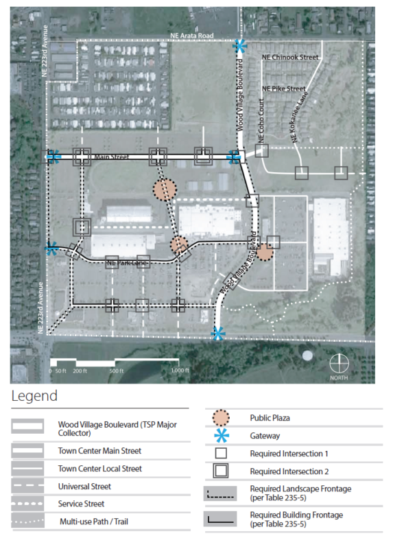
235.410 Concept Plan Regulating Diagram.
A. Purpose. The Concept Plan Regulating Diagram organizes each street (both existing and future streets) into one (1) of five (5) street or path types: Town Center Main Street, Town Center Local Streets, Universal Streets, Service Streets and Multi-Use Paths or Trails. Note that their exact alignment may vary by up to one hundred (100) feet from the locations shown on the diagram; provided, that they fully connect/intersect with each of the streets and intersections as shown. See Section 235.430, Town Center Street and Path Types, for details regarding cross-section designs for each street type.
B. Utilization of Diagram. The Building and Façade Standards by Street Type Table 235-5 outlines the building and façade standards applicable to individual parcels, and is organized by street type. Parcels must comply with the standards for the street type on which the parcel fronts. Parcels with multiple street frontages (corner parcels, for example) must prioritize compliance with the applicable frontage requirements as provided in Section 235.450. Table 235-5 addresses requirements for street frontage, ground floor heights, transparency, primary entry doors and weather protection.
Figure 235-1. Concept Plan Regulating Diagram
(Ord. 3-2021 § 1 (Exh. A))