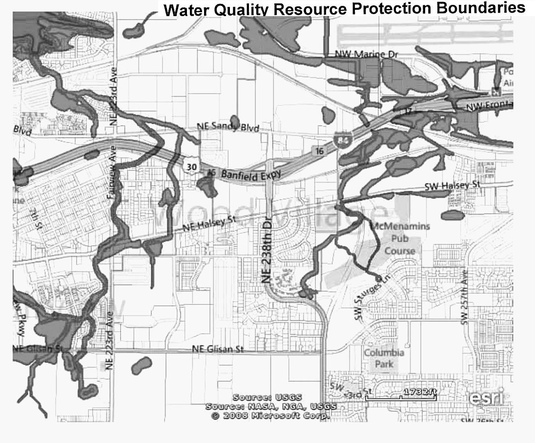
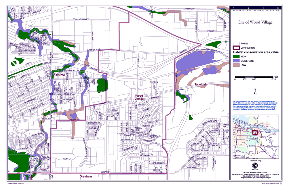
430.120 Map Administration.
A. Intent. The purpose of this Subsection is to provide a process for amending the Water Quality (WQ) map to add wetlands and correct the location of Protected Water Features and the WQRA.
B. Map Corrections.
(1) Within 90 days of receiving information establishing a possible error in the existence or location of a Protected Water Feature or WQRA, the City shall provide notice to interested parties of a public hearing at which the City will review the information.
(2) The City shall amend the WQ map if the information demonstrates:
(a) That a Primary or Secondary Protected Water Feature no longer exists because the area has been legally filled, culverted or developed prior to July 14, 1999; or
(b) The boundaries of the WQRA have changed since adoption of the WQ map.
C. Modification of the Water Quality Resource Area. To modify the WQRA identified on the WQ Map, the applicant shall demonstrate that the modification will offer the same or better protection of the Protected Water Feature and WQRA by:
(1) Preserving a vegetated corridor that will separate the Protected Water Feature from proposed development; and
(2) Preserving existing vegetated cover or enhancing the WQRA sufficient to assist in maintaining or reducing water temperatures in the adjacent Protected Water Feature; and
(3) Enhancing the WQRA sufficient to minimize erosion, nutrient and pollutant loading into the adjacent Protected Water Feature; and
(4) Protecting the vegetated corridor sufficient to provide filtration, infiltration and natural water purification for the adjacent Protected Water Feature; and
(5) Stabilizing slopes adjacent to the Protected Water Feature.
D. Adding Title 3 Wetlands
(1) Within 90 days of receiving evidence that wetland meets any of one of the criteria in D.2. below, the City shall provide notice to interested parties of a public hearing at which the City will review the evidence.
(2) A wetland shall be protected by the standards set forth in this Section if the wetland meets any one of the following criteria:
(a) The wetland is fed by surface flows, sheet flows or precipitation, and has evidence of flooding during the growing season, and has 60 percent or greater vegetated cover, and is over one-half acre in size; or the wetland qualifies as having “intact water quality function” under the 1996 Oregon Freshwater Wetland Assessment Methodology; or
(b) The wetland is in the Flood Management Area, and has evidence of flooding during the growing season, and is five acres or more in size, and has a restricted outlet or no outlet; or the wetland qualifies as having “intact hydrological control function” under the 1996 Oregon Freshwater Wetland Assessment Methodology; or
(c) The wetland or a portion of the wetland is within a horizontal distance of less than one-fourth mile from a water body which meets the Department of Environmental Quality definition of “water quality limited water body” in OAR Chapter 340, Division 41 (1996).